


























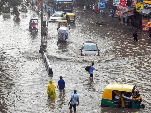
Delhi’s July rain had been falling short of normal all month, and this week too. Safdarjung had recorded 160.3mm against a monthly normal of 195.8mm before Tuesday, and only 27.5mm of that came in the past 15 days, private forecaster Skymet Weather said.
What changed things is a revival of the monsoon combined with a few other weather systems acting together.
What is driving the change?
Also Read | Varanasi school under probe after 5-year-old alleges horrific abuse
The monsoon trough, which is the main rain bearing line of the monsoon, now runs south of Delhi through Bikaner, Gwalior, Satna and Daltonganj, and stretches eastward to the centre of a deep depression. That depression made landfall over the West Bengal and north Odisha coast early Tuesday, the India Meteorological Department (IMD) said in its bulletin.

Independent meteorologist Navdeep Dahiya noted on X that this is the season’s first Bay of Bengal depression to move inland.
Two more weather systems are adding to the effect, according to the IMD bulletin. One is an upper air cyclonic circulation over southwest Rajasthan, sitting at the western end of the monsoon trough. The other is over northern parts of central Uttar Pradesh, closer to Delhi and the National Capital Region.
Understanding the monsoon trough
Through the monsoon months, there is usually a long stretch of low pressure called the monsoon trough. It runs from a heat-driven low over Pakistan to the head of the Bay of Bengal, roughly following the Gangetic plain.
This trough keeps shifting. Its eastern end can move by five degrees of latitude in just one day.
Also Read | CJP unveils legal support plan as Kapil Sibal pledges ₹1 crore
Where the trough sits decides who gets the rain. When it moves south of its usual position, it pulls the heaviest rain toward central and northern India, which is roughly where Delhi and the NCR are placed right now. But when it shifts north toward the Himalayan foothills, the plains dry out, a phase forecasters call a break in the monsoon.
The systems at either end of the trough make things more intense. Both the Rajasthan circulation and the Odisha depression push moisture upward on their own. Since they are linked to the trough, they turn an already favourable setup into a strong, productive one.
Simply put, warm moist air gets pulled into these systems and pushed upward. As this rising air cools, the moisture in it condenses into cloud droplets, which eventually fall as rain.
What this means for farmers and the season ahead

The monsoon’s revival is already showing up in the fields. At the end of June, summer crop sowing was running nearly a quarter behind last year’s pace. That gap has now narrowed to under 5%, according to data from the Union Ministry of Agriculture and Farmers’ Welfare, cited by Reuters.
Also Read | Varanasi school under probe after 5-year-old alleges horrific abuse
Farmers had planted 78.7 million hectares as of July 24, compared with 82.6 million hectares a year earlier. Rice, which farmers plant in sync with the rains, covered 23.4 million hectares, only slightly behind last year.
“We were waiting for rain before transplanting the seedlings. After we received good rainfall this month, we started paddy transplanting,” said Krishna Beuraa, a farmer in Konark, Odisha, speaking to Reuters.
For Delhi and the NCR, the IMD has forecast heavy to very heavy rain at isolated places on July 28 and 29, followed by fairly widespread rain through August 3.
What comes next
Whether this rainy momentum lasts through the rest of the season is a different question. Skymet said in a post on X that the picture for August and September will depend on two big climate factors.
Also Read | NCPCR to Meta: Why wasn’t child sexual abuse content reported to police?
One is El Niño, the Pacific Ocean warming pattern that has historically weakened the Indian monsoon. The other is the Indian Ocean Dipole, a temperature difference between the eastern and western parts of the Indian Ocean, which can either boost or reduce rainfall across the subcontinent.
FAQs
Why does the trough’s position matter so much?
When it shifts south, it pulls heavy rain toward central and northern India, including Delhi. When it shifts north toward the Himalayan foothills, the plains go through a dry spell called a break in the monsoon.
What role did the Bay of Bengal depression play?
It is the season’s first such depression to move inland. It made landfall over West Bengal and north Odisha and is linked to the monsoon trough, which helped intensify the rain.
